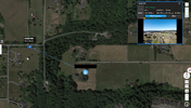
Yea it's quick. Took him about 2 hours to set survey targets, then 20 minutes for the lidar flight and 35 minutes for the photogrammetry flight. He's doing site photos and panoramas right now, then he'll get another shot on all the survey targets before leaving. I'll have all of the imagery, point clouds, 3d models and virtual tours online within 48 hours so the project team can look at it and start planning their own field work. In the mean time, we'll be working on the survey & DTM surface and will have them a survey CAD file within 2 weeks.
The geologist I'm doing this for used to work at the same company as me. He had us do it because he knows I typically give preliminary files within 48 hours and they're planning to mobilize on Monday to the site.
I've given a few presentations lately that essentially boil down to "Give the whole team access to the full UAS datasets, not just the prepared files...", and showing how I do all that. I've been asked to give the same presentation at 2 more conferences coming up, so this is going to be a perfect one to add in as an example.
The main thing I'm excited about though is the 3D model from DJI Terra. ArcPro .SLPK is one of the export options for these crazy 3D models, but I haven't worked with anyone yet that's actually capable of using them. This geologist is a heavy ArcPro user and plans to use it though, so it'll be the first time we incorporate those into a real project.